
Day Outings
The Village of Arroyo Grande is the perfect jumping-off spot for exploring the beauty and attractions of California’s Central Coast, from wine tasting to hiking, from wildlife viewing to beachgoing. Here we share some of the many places that we think are pretty special. They’re listed alphabetically, and distances are from Village 306.
Avila Beach
11 miles
Avila Beach the town is home of Avila Beach the beach, and that alone makes both Avilas worth a visit. The beach is small, but wonderfully protected by framing hills; without question the nicest swimming beach in San Luis Obispo County. The waterfront town, comprising just a few square blocks, has an old-fashioned feel, very pedestrian-friendly, with the obligatory T-shirt shops, snack offerings, bike rentals, a few sit-down restaurants, a microbrewery, and a top-notch coffee house, Kraken Coffee. The landmark town pier is currently getting a makeover, but there’s another pier just north of town that’s the centerpiece of Port San Luis, Avila’s boating/fishing-oriented neighbor, also ideal for kayaking and SUP. It’s the launching pad for a visit (hike, paddle, or van tour) to the 1889 Point San Luis Lighthouse. Avila has a third aspect, the one you pass through between US 101 and the beach. Avila Valley is home to the Bob Jones Trail—a three-mile, car-free way to the beach for hikers and bikers—and two mineral springs resorts. Avila Hot Springs is a modest day-use place with a huge, naturally headed soaking pool, while Sycamore Mineral Springs is a lovely full-service spa, restaurant, and historic hotel tucked up against an oak-studded hillside.
As you approach Avila Beach proper you’ll come upon Avila Valley Barn, a family favorite for great produce, hay rides, pony rides, and baked goods. In summer the Barn hosts Sunday afternoon concerts.
Cambria
47 miles
Cambria’s two distinct aspects, coastal and arty, are different worlds that are both worth exploring. Its coastal strand, Moonstone Beach, is a milelong stretch of bluffs and beach flanked on the inland side by a succession of small inns and upscale motels. The bluffs are laced with trails, and several staircases lead down to the beach. A quick inland turn from the highway puts you on Main Street and its collection of fine-art galleries and boutiques interspersed with coffee houses, wine tasting rooms, and restaurants. Cambria’s artsiness doesn’t feel touristy; there’s an authenticity to the galleries and a farm-to-table earnestness at eateries like Linn’s, which has been proffering fresh pies for more than 40 years. There’s a nice dash of quirkiness, too: a local affinity for faux-Tudor, half-timbered architecture, and a nonpareil work of folk-art in the form of Nit Witt Ridge.
Cayucos
34 miles
As California coastal towns go, Cayucos is like flyover country—highway travelers tend to zip by on their way to Morro Bay or Hearst Castle. All the better for travelers who put on the brakes in this town that distills so much into a small beachside footprint. For one thing, Cayucos is truly on the beach—a broad sandy strand that stretches for miles, clear down to Morro Rock. The water is Central Coast cold, of course, but the surf is good and the beach is never crowded. The heart of the town consists of a single street, Ocean Avenue, lined with mostly old-fashioned facades and by diagonal parking spaces that never seem full. Pretty much every other building houses an antique shop, one of which, called Remember When, hosts a bunch of different vendors on three stores. In other words, even if it’s not a beach day, there’s plenty of cruising to do for collectibles and vintage goodies. Twice a year, the whole street is given over to the Cayucos Antique Street Faire. Don’t miss the historic, 950-foot Cayucos Pier, always worth a stroll to see what they’re catching, or to watch surfers and kiters cutting through the froth.
Grover Beach (the town)
2 miles
Grover Beach is the town just to the west of Arroyo Grande. You drive through it to get to the closest, most accessible beach in the area. Grand Avenue is the main street through Grover, and it’s lined with services, restaurants, and supermarkets.
Grover Beach (the beach)
3 miles
Is the beach here properly called Pismo Beach or Grover Beach? It doesn’t matter. Just know that this is the closest beach to Village 306. Just drive west on Grand Avenue, cross Highway 1, and park. The entire stretch of beach from Shell Beach down to the Oceano Dunes is Pismo State Beach, while the stretch at the foot of Grand Avenue between the towns of Pismo and Oceano is known as Grover Beach. By any name, it’s a broad, flat beach bordered by sand dunes. There’s plenty of free parking here, and a nice little ocean-view restaurant called Fin’s—a great place to sip a beverage and watch the sunset. Or the fog.
The stretch of beach to the north, toward Pismo Pier, is great for walking or beach play. You can walk south too, but the stretch to the south is open to vehicle traffic. You pay a fee and use a ramp for that privilege. The speed limit of 15 mph is strictly enforced.
Also right at the foot of Grand Avenue is Pismo Beach Golf Course (yes, it’s in the town of Grover Beach)—a nifty little par-3, 9-holer.
Hearst Castle
58 miles
Is Hearst Castle a giant, ornate monument to conspicuous wealth? Of course it is! A sprawling tribute to its creator’s immense ego? Ditto!
But hey—it’s our sprawling monument to wealth and ego, gorgeously situated overlooking the San Simeon coast, just south of Big Sur. Its location and its showiness all make the castle a compelling visit and a very California story—how William Randolph Hearst parlayed his father’s wealth (from silver mining during the gold rush) into a media empire (newspapers, and later, film) that financed an estate comprising 165 rooms, 123 acres of gardens, and thousands of pieces of international art.
Hearst never made the castle his full-time home. It was always, in a sense, what it is now — a place where guests could come to relax and be entertained in a grand setting enlivened by a vast collection of art.
So the castle’s slate of tour offerings is perfectly in keeping with Hearst’s intent. Of course, in his day guests were select movie stars, society elites and business moguls. Today, some 850,000 visitors a year traipse through. But whether you’ve been before or not, the newer tours are good news. You can choose from themes like Designing the Dream or Art of San Simeon, and a variety of castle tours such as Grand Rooms (best for first-timers) and Cottages & Kitchen. There are evening and night tours, accessible tours and special holiday-themed tours in season. The castle even has its own app, an innovation the forward-thinking Hearst would applaud.
Best of all, most tours allow visitors free-roaming time once the guided portion is over. You can roam and admire the gardens or linger about the grounds. By then, any cynical notions about the place being gaudy and ostentatious will likely have faded. Hearst Castle is such a feast for eyes and redolent with so much ancient artwork and 20th-century history that you’ll probably give in to its enchantment—and maybe even hang out by the pool for a while.
Lompoc
44 miles
Why Lompoc bills itself as the City of Art and Flowers is apparent as you drive through and around town. Seemingly every downtown building is a giant canvas for local muralists, and if your timing is good, you’ll see broad fields brightly spangled with cultivated flowers arrayed nearby. The fields are constantly rotated, but your best bet is to explore just west of town. The flowers, which are grown for seed, are generally blaring their colors from April through September. As for the murals, there are dozens—you can’t miss them, but they’re worth an appreciative stroll. Some depict local history, some honor nearby Vandenberg Space Force Base, and others are just plain whimsical. Lompoc’s Santa Rita Hills are the westernmost aspect of Santa Barbara Wine Country, and wine tasting here couldn’t be more convenient. The Lompoc Wine Ghetto houses a cluster of urban wineries and tasting rooms in an old industrial complex just a block off Highway 1. Lompoc is also a perfectly situated jumping-off spot for two side trips—west to Jalama Beach for camping, surfing, and wild beach strolling—and east to La Purisima Mission State Historic Park. The 1820s mission is one of the prettiest and most extensively restored missions in the state.
Lopez Lake
9 miles
Lopez is a local treasure even if you’re not into boating and fishing. If you are, you’ll find excellent angling for bass, crappie, catfish, and bluegill. Fish from shore (22 miles of shoreline on the 1,000-acre lake) or rent a boat. The marina even rents fishing gear. If you like things a little speedier, rent a jet ski. If you like things a bit mellower, rent a kayak or SUP (stand-up paddleboard). We’ll assume you’re not going to be camping there since you’re staying in Village 306, but your camping friends can choose from among 300+ sites.
What else can you do at Lopez? Well, you can just drive out and have a look. The drive is gorgeous. Chow down at the Marina Bar & Grill. Hike. Bike. Mountain bike. Picnic. Slide. Slide? Yup. If you’ve got kids in tow, summer is all about sliding at Mustang Waterpark, which features two 600-foot curving waterslides, a 38-foot half-pipe for innertubing and a kiddie pool for waterslide wannabes.
Not adventurous enough for you? (Sheesh!) Challenge yourself at the Vista Lago Adventure Park, a ropes course with a lake view. You can zipline over the lake or test your agility on four different rope itineraries—and there’s a “cub course” for your little ones.
By the way, if it’s foggy at the beach or chilly in the Village, bright sunshine is likely out at Lopez.
Monarch Butterfly Grove
4 miles
A true local treasure is the grove of eucalyptus trees on Highway 1 between Grover Beach and Pismo State Beach’s North Beach Campground, which may or may not be showing more orange and black than green in its high branches. From October to March, this grove attracts overwintering monarch butterflies by the thousands. Or tens of thousands—the numbers of endangered monarchs has surged upward the last couple seasons, after years of disheartening decline. The dense clusters of gently fluttering butterflies make for a stunning sight. A short trail provides gawking perspective, while a kiosk houses docents and souvenirs. Tip: The trail also cuts through sand dunes to a lovely, vehicle-free stretch of Pismo Beach.
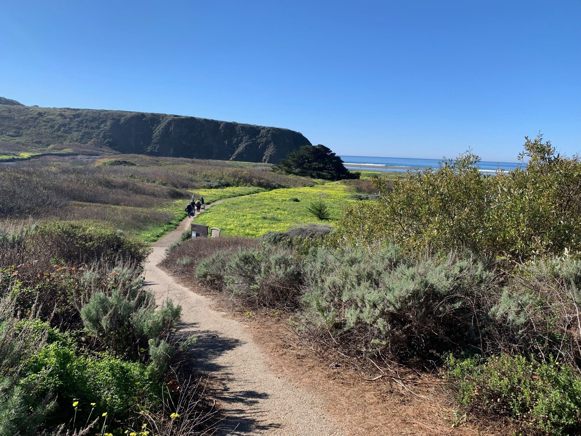
Montaña de Oro State Park
27 miles
It’s something of a bonus Big Sur, this stretch of SLO coast and mountain, and well worth a day trip. Most visitors to Montaña de Oro venture no farther than Spooner’s Cove, a tiny crescent of beach framed by rock formations and tide pools. But there’s also a campground, a dramatic hiking trail that traces the coast along wildflower-strewn bluffs, and a trail that reaches 1,347-foot Valencia Peak for a jaw-dropping view. There’s a bonus to the bonus, too: From the south end of Montaña de Oro, you can access another 3-plus miles of coast on PG&E’s Point Buchon Trail. We highly, highly recommend MDO!
Morro Bay
29 miles
“Three stacks and a rock” isn’t great as far as tourism catchphrases go, especially since Morro Bay has so much more going for it than its obvious landmarks. The town’s trio of 450-foot, curiously beloved smokestacks and the mega dome (576-foot Morro Rock) that punctuates the terminus of a sandspit may dominate the skyline, but what defines Morro Bay is its relationship to the sea. It has long been, and still feels like, a fishing village. Watching the tos and fros of its endemic fishing boats is part of the charm, and there’s no shortage of harborside places for dining on or purchasing catches of the day. Once you start strolling here, you’ll quickly observe that a three-mile-long sandspit frames the oceanfront and protects the harbor. That happy circumstance makes Morro Bay Estuary perfect for sea kayaking and stand-up paddleboarding. Rentals and guided tours are available, and you’ll almost certainly be shadowed by curious pinnipeds and/or sea otters. The town itself stretches up from the estuary to Highway 1, an easily walkable grid with all manner of shops, galleries, and eateries. At the south end of town, Morro Bay State Park is home to a golf course that’s a fair facsimile of Pebble Beach, minus the hefty greens fees.
Oceano Dunes SVRA
5 miles
The state park ramp at the foot of Pier Avenue in Oceano is the gateway to Oceano Dunes State Vehicular Recreation Area, where ATVs and dune buggies can drive on Pismo Beach to access the thousands of acres of sand dunes open to off-road vehicle use. Shops along Pier Avenue rent buggies and ATVs and provide safety equipment, directions and instruction to get you started. The Oceano Dunes Visitor Center near the ramp is also a great resource for all sorts of dune info, including an exhibit about the Dunites, a utopian sect that lived in the dunes in the 1920s and ’30s.
Oso Flaco Lake
11 miles
A freshwater lake in the middle of extensive sand dunes sounds preposterous, but that’s exactly what Oso Flaco is. A short, flat trail leads through willow thickets to a boardwalk that spans the lake, making a walk here a gentle experience. Beyond the lake, the boardwalk leads through the Oceano Dunes to a short trail that opens onto the beach. Technically Oso Flaco is in the Oceano Dunes SVRA, but the dunes and beach are off-limits to vehicles here, making this a serene alternative to the OHV hubbub just to the north. Oso Flaco also has decent bass and bluegill fishing, and it’s a favorite site for birders.
Pismo Beach (the town)
4 miles
Pismo is something of a throwback old California beach town—a mix of casual dives and decent eateries, surf shops and tattoo parlors, souvenir shops and art galleries. A happy hodge-podge. A walk out on Pismo Pier is a must, and the giant, freestanding, illuminated PISMO BEACH sign on Pier Plaza will signify your whereabouts to your Instagram followers.
Pismo has scads of places to eat, but two merit special mention. Pismo Beach Fish & Chips has been serving the best fish and chips on the Central Coast since I was a kid, and that’s a very long time. And Old West Cinnamon Rolls is a treat you deserve. There’s a reason why there’s almost always a line out onto the sidewalk.
A final note about food in Pismo. You might think a place that calls itself the Clam Capital of the World is the place to go for clam chowder. Maybe, but you won’t be eating Pismo Clams. Local bivalves haven’t been commercially harvested for many decades. Local chowder is made with imported clams. For more about clams, see Pismo State Beach below.
Pismo extends north past the fun downtown area, but up there it’s mostly expensive motels and restaurants until you reach the enclave of Shell Beach. Pismo claims Shell Beach within its city limits, but to us locals, Shell Beach is Shell Beach, and deserves its own entry.
Pismo State Beach
3+ miles
Pismo State Beach is the long swath of beach that extends from the town of Pismo down past the Oceano Dunes. The beach is broad and flat, and its firm sand makes it the rare California beach you can drive on. Access points are at the foot of Grand Avenue in Grover Beach and the foot of Pier Avenue in Oceanoa, where you can buy a day-use pass to proceed onto the beach.
Although the beach is wide and expansive with room for everyone and everything, the presence of cars south of Grover and dune buggies and ATVs south of Oceano can make beach play a bit annoying. The stretch north of Grover to the Pismo Pier is closed to traffic, as is a section much farther south adjacent to Oso Flaco Lake (see Oso Flaco Lake below). Those areas are more family-friendly.
No matter where or when you decide to play in the water in Pismo, know that the water is cold. It can sneak up into the low 60s in August and September, but most of the time it’s in the 50s. Brr.
Pismo Beach is home to the famous Pismo clam, and it was clams that essentially put Pismo on the map many years ago. Scads of clamdiggers would venture out into the shallow surf at low tide, piercing the sand with a clam fork. A clunk would signal the presence of a clam. Then the digger would scoop up the clam and measure it with a device (a caliper) mounted to the fork. If the clam exceeded 4-1/2 inches, it was a keeper.
Those were the good old days. By the 1980s, the clams had virtually disappeared. Good news, though: Pismo clams have made a dramatic comeback. You may see some when you walk the beach, but the chances of finding any of legal size are nil. Even if you did, you’d need a California state fishing license to keep one (the limit is 10). Better to just admire them, and help them out by burying them in wet sand. Make sure the clam is vertical, hinge toward the ocean, with the ligament (a small bubble) facing up.
Pismo Preserve
7 miles
My wife and I absolutely love Pismo Preserve—900 acres of oak-studded hills spared from development several years ago and opened to the public in 2020. Wonderfully sculpted trails weave into the landscape, wander into dense oak groves, and serve up vistas of serene mountainscapes and Edna Valley, plus coastline stretching from Port San Luis to Point Sal. Don’t be fooled by its proximity to the highway—after two bends of the trail, all you hear is birdsong and hawk cries. The 11-mile network of trails is open to hikers, equestrians, and mountain bikers. If the parking lot is full, you can park down below on Price Street (Highway 1) just across the freeway.
Side note: If you’re staying in Village 306, the beautiful photo of the oak tree in the primary bedroom was taken in Pismo Preserve. The tree is known as the Lone Oak.
San Luis Obispo
15 miles
When I was growing up in Arroyo Grande, SLO was the big city. I was always a bit in awe. And I still am in a way. It’s beautiful, tasteful, and has all of the necessities of life. The same qualities that put San Luis Obispo on so many lists of best places to live and happiest places on Earth also make it one of the coolest cities to visit in California. It’s a vibrant college town (Cal Poly San Luis Obispo) with historical charm—Mission San Luis Obispo de Tolosa is smack dab in the center—that’s walkable, bikeable, and enjoys perpetual great weather. If you’re not sipping java at a Scout Coffee sidewalk table you’re dining by candlelight next to San Luis Obispo Creek, which snakes through the downtown core. It’s also the cynosure of a burgeoning wine region, distinct from the Paso Robles version just to the north. SLO’s wineries are arrayed south of town in the Edna Valley and Arroyo Grande Valley—gorgeous country. In town, drop by Region, a tasting room in downtown SLO that represents 26 local wineries. SLO also has great hiking and views in the Irish Hills and the town’s signature summit, Bishop Peak.
Shell Beach
6 miles
Shell Beach may be within Pismo city limits, but the enclave totally has its own character, with sheer cliffs to walk, coves to kayak, ocean-view homes to admire, and some good places to eat. From the south, Shell Beach starts at Dinosaur Caves Park, an extensive grassy area overlooking wave-worn headlands. It’s a great place to picnic and to let the small fry frolic on a wonderful playground. From there you can walk or drive along Ocean Boulevard and enjoy some of the best views in the area. If you become intrigued with Shell Beach’s coves and caves, kayaking is the way to explore them. Central Coast Kayaks offers guided tours.
My food recco in Shell Beach: Zorro’s for breakfast or brunch, or for darn good Mexican anytime.
Shell Beach is also home to Beach Bum Holiday Rentals, the friendly folks who manage Village 306. Across the freeway is the wonderful hiking gem, Pismo Preserve, which deserves its own write-up (see Pismo Preserve).